
Investigation 1B:
Evaporation and Climate
Evapotranspiration
Vegetation Information from Satellites
Since the early 1970's, satellites orbiting the Earth have been used to monitor the vigor of vegetation. This information has been applied in the measurement of evapotranspiration, vegetative stress, and drought severity on a regional scale.
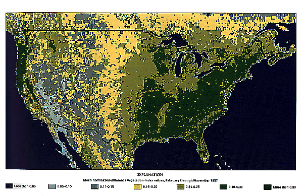
An image provided by the U.S. Geological Survey is shown in Figure 4, below. The image represents the mean of 43 weekly images collected by the NOAA-9 satellite from February through November 1987. The map shows variations in "greenness" that relate directly to variations in density of vegetative cover, plant vigor, and the seasonal duration of vegetative growth.
- Which areas of the U.S. have a lot of "greenness", i.e. a lot of vegetation according to the index in the map above?
- Which areas of the U.S. are "less green" by this index?

